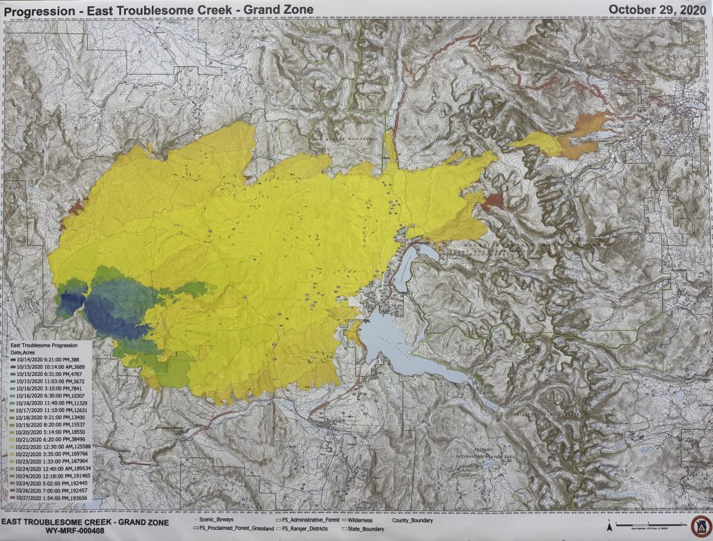
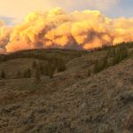
Map and timeline: How the East Troublesome Fire blew up into second largest wildfire in Colorado history

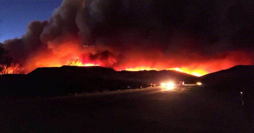
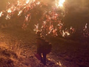
East Troublesome Fire information office/Courtesy photo
Oct. 14
• The East Troublesome Fire ignited around noon in the Arapaho National Forest, northwest of Kremmling, near Big Horn Park. The fire was first spotted by an elk hunter who reported smoke in a remote, roadless area.
• Residents of Big Horn Park and County Road 21 were evacuated to the Kremmling Fairgrounds by 4:30 p.m.
• Fire crews struggled to access the fire due to rugged terrain and lack of roads.
Oct. 15
• Fueled by dry conditions and strong winds, the fire grew to 5,684 acres with 0% containment.
• Mandatory evacuations were ordered along County Roads 214 and 217.
• Pre-evacuation notices extended along Highway 40, stopping short of Hot Sulphur Springs.
Oct. 16
Fire expanded to 11,329 acres.
• Pre-evacuation notices were issued for the west side of U.S. Highway 34 and east of Colorado Highway 125.
• Sheriff’s Creek and Kinney Creek areas were evacuated around 7:30 p.m.
• Oct. 17-19
• Fire grew steadily to 15,537 acres.
• Highway 125 was closed at mile marker 5.
• Big Horn Park was downgraded to pre-evacuation status.
Oct. 20
• Fire reached at 19,089 acres with 10% containment.
• Evacuations expanded to Drowsy Water Creek and areas west of Highway 125 from U.S. Highway 40 to mile post 5.
Oct. 21
• The fire crossed Highway 125 at Cabin Creek and exploded in size, jumping to 38,436 acres.
• It surged across the US Highway 34 corridor, reaching Grand Lake and entering Rocky Mountain National Park.
• Trail Creek Subdivision was evacuated at 6:30 p.m., followed by the entire Highway 34 corridor from Granby to Grand Lake.
• The fire burned over 100,000 acres in a single day destroying hundreds of homes and claiming two lives — Lyle and Marilyn Hileman, who chose to remain in their beloved home near Grand Lake.
Oct. 22-23
• Fire ballooned to 187,964 acres and crossed the Continental Divide, threatening Estes Park.
• Granby and Hot Sulphur Springs were placed under pre-evacuation.
Oct. 24-26
• Snowfall helped slow the fire’s advance.
• Fire measured at 192,560 acres while its containment increased to 20%.
• Grand Lake and the east side of Highway 34 corridor reopened.
Oct. 28-Nov. 6
• Fire reached its final size of 193,812 acres.
• Areas north of Highway 40 between Hot Sulphur Springs to Highway 125 including Sheriff’s Creek, Kinney Creek and Drowsy Water Ranch are reduced to pre-evacuation.
• Containment held at 37%.
• Highway 125 reopened to mile marker 5. and the areas west of Highway 34 reopened to the public.
Nov. 30
• After 48 days, the East Troublesome Fire was declared 100% contained.


Support Local Journalism
Support Local Journalism
The Sky-Hi News strives to deliver powerful stories that spark emotion and focus on the place we live.
Over the past year, contributions from readers like you helped to fund some of our most important reporting, including coverage of the East Troublesome Fire.
If you value local journalism, consider making a contribution to our newsroom in support of the work we do.