Williams Fork Fire grows to 6,000 acres; closure issued around Byers Peak

-
ARP-SRD-2020-06-WilliamsForkFire_Order-08152020-signed
-
Williams Fork Fire from County Road 3 on Saturday, Aug. 15, 2020.
Courtesy Amy Noraka
-
Williams Fork Fire from County Road 3 on Saturday, Aug. 15, 2020.
Courtesy Amy Noraka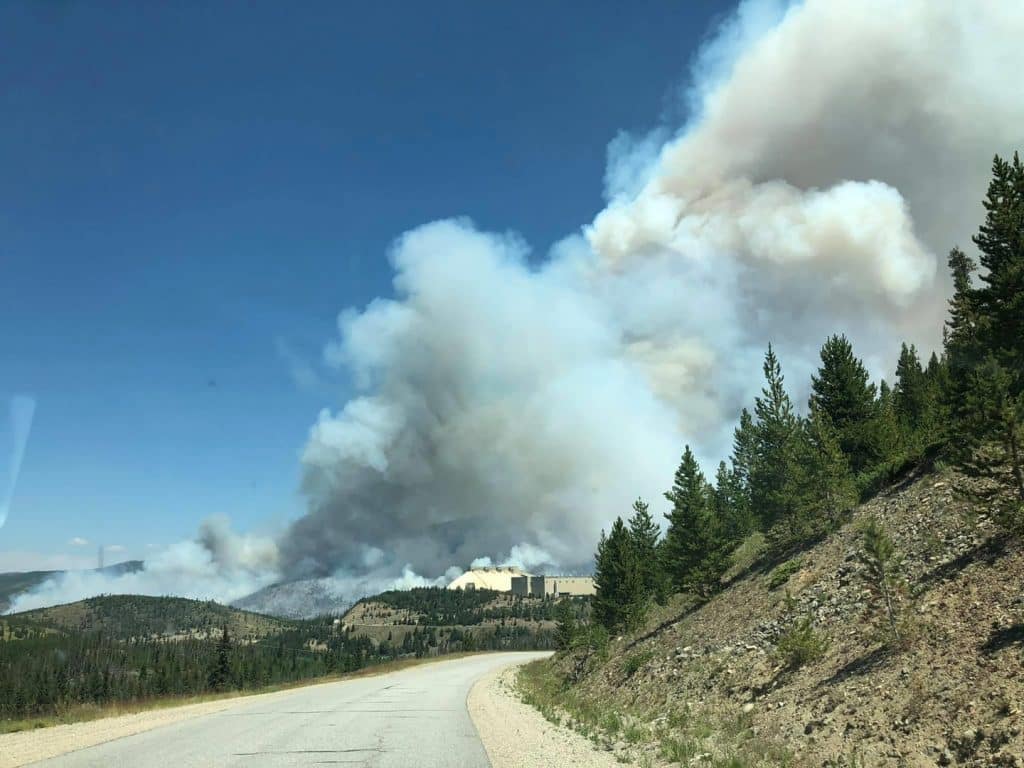
-
-
Williams Fork Fire from County Road 3 on Saturday, Aug. 15, 2020.
Courtesy Amy Noraka
-
Williams Fork Fire from County Road 3 on Saturday, Aug. 15, 2020.
Courtesy Amy Noraka
-
Williams Fork Fire from County Road 3 on Saturday, Aug. 15, 2020.
Courtesy Amy Noraka
-
Williams Fork Fire on Saturday, Aug. 15, 2020.
Courtesy Maryann Naylor
-
Williams Fork Fire on Saturday, Aug. 15, 2020.
Courtesy Maryann Naylor
-
Williams Fork Fire on Saturday, Aug. 15, 2020.
Courtesy Maryann Naylor
-
Williams Fork Fire from County Road 3 on Saturday, Aug. 15, 2020.
Courtesy Amy Noraka
-
Williams Fork Fire from County Road 3 on Saturday, Aug. 15, 2020.
Courtesy Amy Noraka
-
Williams Fork Fire at 7:30 p.m., Friday, Aug. 14.
Eli Pace / epace@skyhinews.com
-
The Williams Fork Fire has grown to over 1,300 acres in Grand County, located 15 miles northwest of Fraser. The fire started around noon Friday.
Courtesy US Forest Service
-
Williams Fork Fire at 7:30 p.m., Friday, Aug. 14.
Eli Pace / epace@skyhinews.com
-
Screen Shot 2020-08-14 at 9.26.28 PM
-
William Fork Fire on Friday, Aug. 14, 2020.

-
Airplanes battle the Williams Creek Fire on Friday, Aug. 14.
Eli Pace / epace@skyhinews.com
-
Williams Fork Fire at 7:30 p.m., Friday, Aug. 14.
Eli Pace / epace@skyhinews.com
-
Williams Fork Fire at 7:30 p.m., Friday, Aug. 14.
Eli Pace / epace@skyhinews.com
-
Williams Fork Fire at 7:30 p.m., Friday, Aug. 14.
Eli Pace / epace@skyhinews.com
-
Williams Creek Fire at 7:30 p.m., Friday, Aug. 14.
Eli Pace / epace@skyhinews.com
-
Fraser resident Ken Ball caught a photo of the sun shining through the smoke around 7 a.m. Sunday.
Courtesy Ken Ball
-
The Williams Fork Fire smoke plume can be seen from Grand Elk in Granby on Saturday evening.
Courtesy Julie Eichler
-
The smoke plume from the Williams Fork Fire as seen from Meadow Ridge on Sunday morning.
Reader Submitted
Update 5:30 p.m.: The Williams Fork Fire is burning 6,345 acres about seven miles away from Fraser and remains 0% contained.
In a community briefing, fire officials said Sunday’s lower temperatures and lighter winds were favorable and helped keep the fire west of County Road 3.
Crews are working to build a containment line north of the blaze. Incident Commander Ed LeBlanc estimated an October containment date for the fire.
No structures are currently threatened, but the Grand County Sheriff’s Office and Fraser Winter Park Police Department identified 15 areas near Fraser for potential evacuation if needed.
Editor’s note: An earlier version of this story had incorrect information about Winter Park Resort operations. The resort is not part of the Forest Service closure.
Update 4:30 p.m.: The Grand County Sheriff’s Office and the Fraser Winter Park Police Department continue to work on evacuation plans for the town of Fraser as the Williams Fork Fire continues to burn.
In a letter to the community, the police note that no pre-evacuation or evacuation orders have been issued within the town of Fraser, but that officials are preparing for the possibility.
While most of the fire growth today has been toward the south, the letter notes the flames have spread slightly east approaching Lake Evelyn.
Once police have established evacuation zones and routes, as well as check-in spots in town, they will be shared with the public. Fraser Winter Park Police Chief Glen Trainor expected that information to be ready later Sunday or early Monday.
Another online community meeting will be held on the Grand County Sheriff’s Office Facebook page at 5 p.m. Sunday.
Update 10 a.m.: The Williams Fork Fire has grown to approximately 6,000 acres overnight and fire officials are working on additional evacuation plans around Fraser in case they’re needed.
No new evacuations or pre-evacuations have been put in place, but a public information officer for the Williams Fork Fire said that activity continues to be extreme and they want to be prepared.
The US Forest Service has closed the Arapaho National Forest surrounding the fire. The closure includes the Byers Peak Wilderness and the Fraser Experimental Forest, as well as trailheads and campgrounds in the area.
With hot and dry conditions expected throughout Sunday, fire crews are preparing for continuous, rapid growth, according to Ed LeBlanc, incident commander for the Williams Fork Fire.
While fire managers hoped to keep the flames north of Darling Creek, the Williams Fork Fire burned into that area overnight, as well as expanded into the Byers Peak Wilderness.
The fire boundaries east of County Road 30 and south of Keyser Creek Road (Forest Service Road 139) have been maintained and crews hope to keep the blaze from crossing those borders.
A visible plume can still be seen across Middle Park, the Williams Fork Valley, Summit County and beyond.
Saturday’s firefighting efforts focused on protecting infrastructure and high resource values in the area, and planes dropped retardant on the fire throughout the day.
A Type 3 Incident Management Team is currently working the Williams Fork Fire and preparing to transition to a Type 2 Incident Management Team, which is experienced in managing larger, more complex fires
The Type 2 team is planning to assume command of the fire at 6 a.m. Monday.
Since there are currently four large fires burning on the Western Slope, LeBlanc noted that there continues to be a high demand for firefighting resources.
Closures: All access to the Church Park area is closed including: Forest Service Road 133, Forest Service Road 139, County Road 30, County Road 3, County Road 3 and County Road 50 at Young Life Camp.
Evacuation Areas: West: CR 3 and CR 30, North: Keyser Creek, South: Darling Creek, East: Church Park
Pre-Evacuations Areas: CR 50, CR 50S, CR 73, Aspen Canyon, Morgan Gulch, and Henderson Mill
Notifications: Sign up for CodeRed at http://www.gcemergency.com
Public Information Line: 970-445-2910 open 9 a.m. to 9 p.m.


Support Local Journalism
Support Local Journalism
The Sky-Hi News strives to deliver powerful stories that spark emotion and focus on the place we live.
Over the past year, contributions from readers like you helped to fund some of our most important reporting, including coverage of the East Troublesome Fire.
If you value local journalism, consider making a contribution to our newsroom in support of the work we do.